
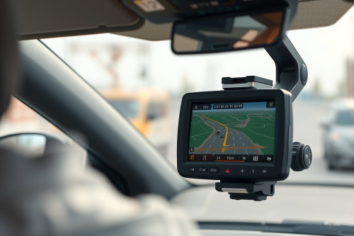
Highway work zones turn standard route algorithms into pure chaos within seconds. After logging 120,000 km across torn-up interstates, I have seen basic smartphone mapping fail when concrete barriers crush line-of-sight reception. Surviving these transit corridors requires dedicated hardware built specifically for navigating active construction zones. You need processing power and dependable receivers to stay on track when lane markers disappear.
The Reality of Navigating Active Construction Zones with Consumer Tech
Consumer devices fall apart in rough transit areas. When you drive between heavy excavators and 3m concrete k-rails, standard phone signals bounce wildly. Multipath reflection corrupts positional calculation. This creates artificial location jumps that confuse basic software.
Standard mobile mounts also bake against your windshield. Heat throttles internal chipsets within 20 minutes. As internal operating temperatures cross 45°C, clock speeds drop to protect silicon. The result is visual freeze right at an unmarked highway divergence. Dedicated gps navigation hardware solves this by utilizing integrated heatsinks and broad ceramic antennas tuned to raw satellite bands.
Core Hardware Specs for Navigating Active Construction Zones
Modern bypass corridors require rapid coordinate acquisition. You can't afford to wait 45 seconds for a warm lock when barreling toward temporary concrete barriers.
GNSS Receivers and Signal Triangulation
Never rely on a single satellite constellation. Multi-constellation receivers pull concurrent fixes from GPS, GLONASS, and Galileo networks. Efficient signal triangulation demands at least 14 tracked satellites under open skies. In high-walled work cuts, that number drops to 6 or 7. Multi-band receivers lock dual frequencies (L1 and L5) to punch through electrical interference generated by heavy diesel machinery and mobile floodlight generators.
Inertial Sensors and Dead Reckoning
Physical blockages are routine in work sites. When steel bridge staging cuts the sky completely, pure satellite data ceases. Hardware equipped with an internal accelerometer and high-accuracy gyroscopes utilizes dead reckoning to project your trajectory. The unit computes velocity, yaw, and tire rotation intervals without receiving a single satellite packet. This ensures continuous track continuity through covered roadworks.
Solving Latency Lag and Preventing Rerouting Loops
Torn asphalt and shifting cones force sudden, unmapped deviations. If your device suffers from extreme latency lag, the recalculation fires 200m past your necessary exit.
Sluggish units get stuck in endless recalculation cycles. Preventing rerouting loops requires a minimum processor refresh rate of 5Hz to 10Hz. Standard consumer units cycle at 1Hz, refreshing your position once per second. At 100 km/h, your car travels 28m between updates. Fast onboard processors cross-reference your heading instantly. They calculate detours immediately without commanding illegal U-turns across concrete dividers.
Choosing the best gps navigation for car usage means checking local memory cache sizes. Units with at least 2GB of onboard operational RAM store vector tile layers locally, removing reliance on patchy roadside cell towers.
Display Performance Under Severe Highway Glare
Roadworks strip away roadside foliage and overhead signage, leaving your dashboard exposed to harsh direct sunlight. Uncoated screens suffer from immediate glare washout, making vital exit prompts invisible.
Seek automotive screens outputting at least 800 nits of active luminance. Anything lower washes out under midday sunlight. Capacitive touch surfaces also behave erratically when dust coats the panel or air conditioning creates moisture beads. High humidity and static charges cause capacitive ghosting, triggering false inputs and resetting your map view. Ruggedized capacitive displays with specialized optical bonding reject false surface charges and maintain legibility.
Selecting the Best GPS for Car Deployment in Rough Corridors
Direct vehicle integration offers major stability gains over temporary suction cradles. Severe washboard asphalt in work zones vibrates mounts at frequencies up to 40Hz. Flimsy ball-head arms loosen, dropping your screen onto the transmission tunnel.
The best gps for car setups relies on magnetic high-retention docks hardwired straight to 12V vehicle power. Running units off cheap 5V cigarette lighter adapters frequently causes voltage drops. When current drops below 1.5A, screen backlights dim automatically and processing cycles drop down, increasing detour computation times.
Final Assessment for Navigating Active Construction Zones
Tackling irregular detours comes down to hardware reliability rather than flashy app animations. Before leaving the garage, verify your firmware update pipeline, inspect the rigidity of your dash mount, and confirm that dual-frequency satellite acquisition functions properly. Dependable processing and clear visibility will get you through the roughest bypasses without surprise detours. Audit your navigation hardware before driving into your next active highway work project.